Eco-points in natural region D64
Donau-Iller-Lech-Platten
Eco-points in the Donau-Iller-Lech-Platten natural region (D64) arise where bogs, floodplains and structurally poor agricultural landscapes on both sides of the Iller are ecologically upgraded. greeNature develops and manages compensation land in Baden-Württemberg (the Ulm area, Alb-Donau-Kreis, Biberach, western Oberschwaben) and in Bavarian Swabia as a partner for municipalities, project developers and landowners.
Natural region D64 at a glance
The Donau-Iller-Lech-Platten (BfN major natural region D64) form a large part of the northern Alpine foreland not glaciated during the last ice age. The natural region extends on both sides of the Iller across two federal states: in Baden-Württemberg, it comprises the Ulm area, the Alb-Donau-Kreis, the Biberach district and parts of western Oberschwaben; in Bavaria, it extends across large parts of Bavarian Swabia between the Iller, Lech and Danube. As a broad triangle, it stretches from Sigmaringen in the west to an eastern edge running from Donauwörth through Augsburg to the Kaufbeuren area.
Geologically, this is an old moraine and gravel-plateau landscape. Tributaries of the Danube deposited extensive gravel terraces during the Pleistocene, shaped during the Riss and Mindel ice ages and later partly cleared out again. Thick sheet gravels overlie the Upper Freshwater Molasse, frequently covered by loess loam. The box-shaped valleys of the Iller, Roth, Günz, Mindel, Zusam, Schmutter, Wertach and Lech divide the area into flat ridges and gravel plains.
Ecologically, the large bog and fen areas stand out. On the Baden-Württemberg side lie the Federseemoor near Bad Buchau, the largest contiguous bog area in south-west Germany and an EU bird sanctuary of exceptional species richness, as well as the Donauried with the Langenauer Ried north of Ulm. In the Bavarian part, the Schwäbisches Donaumoos follows as an important meadow-breeding-bird area. West of Augsburg, the Augsburg-Westliche Wälder Nature Park, with its broadleaf mixed woodland, shapes the landscape.
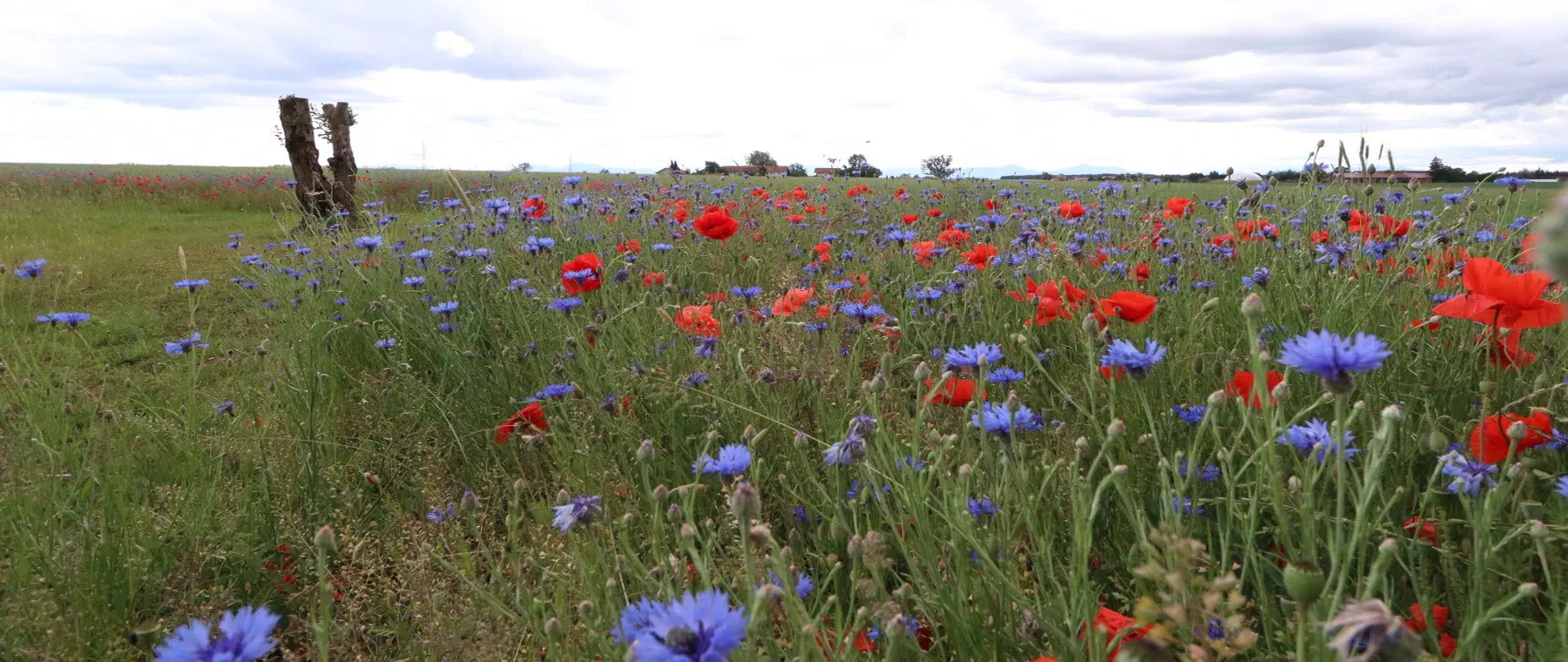
On the intensively used gravel plateaus, by contrast, spruce plantations and arable land dominate, which is why the statutory share of protected areas there is low. It is precisely this high proportion of unnatural habitats that offers considerable upgrading potential. Small-scale structures such as hedgerows, woodland edges, traditional orchards and species-rich meadows, the restoration of watercourses and floodplains, and the rewetting of bogs can be effectively implemented here as compensation and replacement measures.
📍 Districts covered
🌿 Ecological features
- The Federseemoor near Bad Buchau (Biberach district) is the largest contiguous bog area in south-west Germany, an EU bird sanctuary and FFH site of exceptional species richness.
- The Donauried with the Langenauer Ried north of Ulm is an important fen and meadow-breeding-bird area on the border of Baden-Württemberg and Bavaria.
- In the Bavarian part, the Schwäbisches Donaumoos forms an extensive wetland and bird sanctuary for meadow-breeding birds such as northern lapwing and Eurasian curlew.
- The Augsburg-Westliche Wälder Nature Park protects extensive broadleaf mixed woodland with populations of European wildcat and black stork.
- The landscape is an ice-age old moraine and gravel-plateau landscape from the Riss and Mindel ice ages, divided by the valleys of the Iller, Günz, Mindel, Zusam and Lech.
- Spruce plantations and arable land predominate on the intensively used gravel plateaus; the statutory share of protected areas there is low.
- The low protection status of large sub-areas opens up considerable potential for high-quality compensation and upgrading measures.
✅ greeNature in this region
As a nationwide specialist firm for nature conservation compensation, greeNature supports projects in the Donau-Iller-Lech-Platten across state borders. In Baden-Württemberg, we work under the Eco-Account Ordinance (ÖKVO); in the Bavarian part, under the Bavarian Compensation Ordinance (BayKompV). We know the regional focal points, such as the bog areas around the Federsee and in the Donauried, the watercourse axes of the Iller, Danube and Lech, and the cleared gravel plateaus, and develop legally sound measures from them. From land search, through the nature conservation concept, to management and monitoring, we handle implementation and coordinate the eco-accounts with the responsible lower nature conservation authorities.
Typical measures in natural region D64
Bog rewetting
Rewetting drained fen and litter-meadow bogs in the Federseemoor, the Donauried and the Schwäbisches Donaumoos. This stabilises the water balance, binds carbon and creates habitat for meadow-breeding birds.
Extensification of wet and litter meadows
Restoring and extensively managing species-rich wet and litter meadows in the valley spaces and Ried areas. Adapted mowing and forgoing fertiliser support meadow-breeding birds such as the northern lapwing and the typical meadow flora.
Restoration of watercourses and floodplains
Creating riparian buffer strips, reactivating floodplains and promoting self-dynamic development on the Iller, Danube, Lech, Günz and Mindel. Near-natural banks and floodplain forest improve habitat networks and watercourse ecology.
Forest conversion to site-appropriate mixed woodland
Converting structurally poor spruce plantations on the ridges into near-natural broadleaf and mixed woodland with beech, oak and fir. This increases structural and species diversity and makes the stands more climate-stable.
Dry habitats and spawning waters
Creating sand and stone structures, sunlit embankments and fish-free small water bodies as CEF measures for sand lizard, great crested newt and natterjack toad on and around the gravel plateaus.
Structural enrichment of the agricultural landscape
Creating new hedgerows, field copses, traditional orchards and field balks in the cleared farmland. Such small-scale structures connect habitats and provide food and cover for farmland birds and insects.
Protected species in the Donau-Iller-Lech-Platten
Northern lapwing
The northern lapwing breeds in the wet and litter meadows of the Donauried, at the Federsee and in the Schwäbisches Donaumoos, among the most important meadow-breeding-bird areas in the region. Extensively managed, wet grassland and late mowing dates are crucial for breeding success.
About this species ›Skylark
On the wide arable areas of the gravel plateaus, the skylark is a characteristic yet declining breeding bird of the open farmland. Measures such as skylark plots, flowering strips and extensive field margins improve its habitat.
About this species ›European wildcat
The European wildcat lives in the contiguous broadleaf mixed woodland of the Augsburg-Westliche Wälder Nature Park. As an umbrella species, black stork, hazel dormouse and Bechstein's bat also benefit from structurally rich, unfragmented woodland.
About this species ›Kingfisher
The kingfisher hunts along the near-natural sections of the Iller, Danube, Lech, Günz and Mindel. It depends on steep, open eroding banks for its nesting burrows and on clear, fish-rich waters, such as those created by restoration and riparian buffer strips.
About this species ›Sand lizard
The sand lizard finds suitable habitats on the warm, dry embankments, railway embankments and extraction sites of the gravel plateaus. It is among the species frequently affected by impacts, for which advance CEF measures become necessary under § 44 BNatSchG.
About this species ›Great crested newt
The great crested newt inhabits fish-free small water bodies and bog pools in the Ried areas and river lowlands. Creating sunlit spawning waters and connected terrestrial habitats is a proven compensation and CEF measure for this strictly protected species.
About this species ›Your route to eco-points in D64
Contact and enquiry
Tell us your compensation requirement and the natural region. We check availability.
Offer and advice
A transparent offer covering measure types, scope and availability.
Coordination with authorities
Full coordination with the lower nature conservation authority. We handle everything.
Long-term monitoring
Permanent securing of the land, management and documentation across the contract term.
Eco-points in neighbouring natural regions
All about natural region D64
Request eco-points in natural region D64
We will promptly prepare a transparent offer with matching eco-points held in stock in the Donau-Iller-Lech-Platten.