Eco-points and compensation areas
District of Wetteraukreis
Readily available eco-points from officially administered eco-accounts. greeNature is your full-service partner for compensation under the Hessian Compensation Regulation (KV) in Wetterau between Taunus and Vogelsberg
The District of Wetteraukreis at a glance
Wetterau district lies in the centre of Hesse north of the Rhine-Main conurbation and belongs to Darmstadt administrative region. The district seat is Friedberg (Hesse). The district is characterised by the Wetterau itself, one of Germany's most fertile arable regions, framed in the west by the Taunus and in the east by the Vogelsberg
By natural region, the district's core lies in BfN natural region D53 (Upper Rhine Plain and Rhine-Main Lowland). The western marginal areas extend into natural region D41 (Taunus), the eastern ones into natural region D47 (East Hessian upland and Vogelsberg). Over tertiary loose sediments lie substantial loess covers that slope the land from approximately 250 metres in the north to about 150 metres in the south. The defining rivers, Wetter, Horloff, Nidda and Nidder originate in Vogelsberg and drain to the Main
Ecologically significant is the Wetterau floodplain network, at approximately 7,400 hectares Hesse's largest landscape conservation area. It comprises numerous nature reserves and several FFH areas of the Natura-2000 network plus the large-scale Wetterau bird protection area. Centrepieces are the wet meadows and fens of Horloff and Nidda floodplains, such as Bingenheim fen, important breeding and resting areas for meadow birds such as the northern lapwing. Small-scale, rare inland saline areas with salt-loving vegetation occur in Wetterau
Economically, the district combines intensive agriculture on loess soils with strong settlement and commercial pressure in the Frankfurt hinterland, where towns such as Bad Vilbel and Karben are growing significantly. Transport axes such as A5, A45 and A661 plus rail network expansion cross the district. Settlement development, infrastructure and renewable energy regularly trigger impacts whose compensation under sections 13 to 15 of the Federal Nature Conservation Act (BNatSchG) in combination with the Hessian Compensation Regulation (KV) must be provided
🗺️ Associated natural regions
Go to natural region D53 ›
Go to natural region D47 ›
Go to natural region D55 ›
📍 Selected municipalities
🌿 Ecological features
- Wetterau floodplain network, at approximately 7,400 hectares Hesse's largest landscape conservation area
- Wetterau bird protection area and FFH area Grassland areas in Wetterau (Natura 2000)
- Bingenheim fen in Horloff floodplain, important breeding and resting area for meadow birds
- Nidder floodplains from Stockheim with wet meadows and floodplain waters
- Inland saline areas with rare salt-loving vegetation as a small-scale special feature
- Fertile loess arable landscape of Wetterau, habitat for skylarks and field birds
- Forested marginal areas of Taunus (D41) and Vogelsberg (D47) with beech and oak forests
✅ greeNature on the ground
greeNature works nationwide and knows administrative structures and state law in Hesse from practice. In Wetterau district, we assign measures to the Hessian Compensation Regulation (KV), assess impacts and compensation using the biotope value method in eco-points, and coordinate eco-accounts with the lower nature conservation authority of the district. We take account of the natural region location between Rhine-Main Lowland (D53), Taunus (D41) and Vogelsberg (D47) as well as the sensitive floodplain and wetland areas of the Wetterau floodplain network
Typical measures in the district of Wetteraukreis
Wet meadows and fens in floodplains
Rewetting and extensive management of wet meadows in floodplains of Wetter, Horloff, Nidda and Nidder, for example around Bingenheim fen. Such measures secure habitats for meadow birds and amphibians and upgrade the Wetterau floodplain network
Water and floodplain restoration
Removal of bank defences, reconnection of oxbows and ecological development of banks on Wetterau rivers. This creates steep banks, gravel bars and floodplain forest structures as habitat for kingfisher, fish and dragonflies
Arable extensification and flower areas
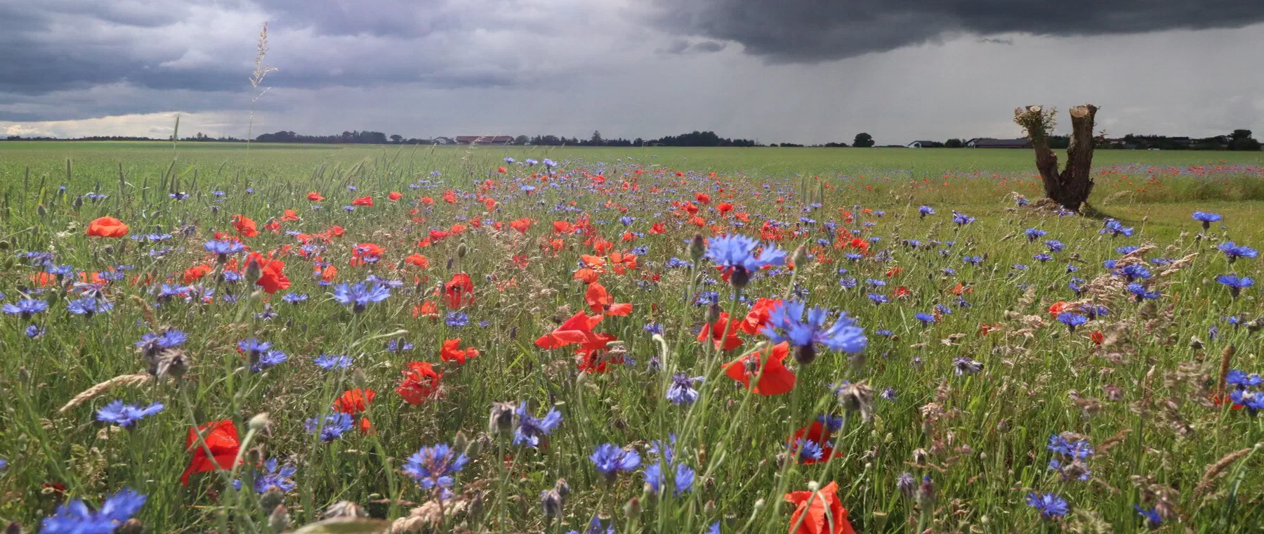
Conversion of intensively managed loess arable land into extensively managed edge areas, flower areas and skylark access windows in the open fields of Wetterau. These measures promote skylarks, partridges and hamsters plus insect diversity
Traditional orchards and hedgerows
Creation and management of traditional orchards, hedgerows and woodland copses on loess slopes and margins of Taunus and Vogelsberg. Such structures network habitats and create stepping-stone biotopes in the open farmland
Species protection CEF and FCS
Replacement habitats for sand lizards on railway embankments and basalt slopes, breeding waters for amphibians including great crested newt, bat roosts on buildings and in traditional orchards, each as an advanced CEF measure or population-supporting FCS measure under sections 44 and 45 of the Federal Nature Conservation Act (BNatSchG)
Woodland conversion and habitat networking
Development of site-appropriate broadleaf and broadleaf mixed forests with old and dead wood components in forested marginal areas of Taunus and Vogelsberg. This strengthens habitats for the European wildcat and black stork and ecologically upgrades forest margins
Protected species in the Wetterau between Taunus and Vogelsberg
Northern lapwing and meadow birds
The wet meadows and fens of Horloff and Nidda floodplains, such as Bingenheim fen, rank among the important breeding and resting areas for northern lapwings, snipe and further meadow birds. Typical compensation measures are rewetting, adapted mowing and predation protection
About this species ›Skylark in open fields
The extensive loess arable areas of Wetterau are habitat for the skylark and other field birds. Flower areas, skylark access windows and extensive margins create breeding and feeding habitat to offset impacts on open farmland
About this species ›Amphibians and great crested newt
In floodplain waters and wet depressions, great crested newt, tree frog and common toad occur. Newly created or restored breeding waters are frequent CEF measures in projects near water
About this species ›Kingfisher on the rivers
Wetter, Nidda, Horloff and Nidder provide kingfishers with breeding and hunting territories. Ecologically sound bank development with steep banks and structured slopes secures and creates suitable habitats
About this species ›Sand lizard on dry locations
Railway embankments, basalt slopes and warm, dry margins are habitat for the sand lizard protected under Annex IV of the FFH Directive. It is a frequent target species in infrastructure and settlement projects and generally requires advanced CEF replacement habitats
About this species ›Black stork at forest edge
In the forested marginal areas of Vogelsberg and Taunus, the black stork and further disturbance-sensitive species find feeding and breeding habitat. Ecologically sound stream floodplains and undisturbed old growth stands are crucial for their retention
About this species ›Which projects trigger a compensation obligation?
Transport and infrastructure
Motorways A5, A45 and A661 cross the district, plus expansion of federal and state roads and rail network measures. Expansion and new construction regularly trigger compensation and replacement obligations assessed in eco-points under the Hessian KV
Settlement development in Frankfurt hinterland
Towns such as Bad Vilbel and Karben grow significantly in the southern district. Residential and commercial areas generate substantial compensation requirements. Landowners of arable and grassland can offer their land as compensation areas
Renewable energy
Wind power locations on Vogelsberg and Taunus margins and free-space photovoltaic systems on arable locations require nature conservation compensation. Species protection assessments and CEF measures are required where species are affected
Agriculture and land use
The fertile loess soils of Wetterau face high usage pressure. Land consolidation, water development and land use changes equally offer starting points for high-value compensation measures in floodplains and open fields
From enquiry to monitoring
Contact and enquiry
Tell us your compensation requirement and the natural region. We check availability.
Offer and advice
A transparent offer covering measure types, scope and availability.
Coordination with authorities
Full coordination with the lower nature conservation authority. We handle everything.
Long-term monitoring
Permanent securing of the land, management and documentation across the contract term.
Eco-points in adjoining districts
All about eco-points
in the district of Wetteraukreis
Request eco-points in the district of Wetteraukreis
We will promptly prepare a transparent offer with matching eco-points held in stock in the district of Wetteraukreis.